Site acquisition decisions carry consequences across the development timeline. Condition issues discovered after a purchase closes create delays, redesign requirements, and budget revisions that a pre-acquisition assessment could have surfaced before commitments were made. Aerial survey programs have become a standard component of developer checks precisely because they surface site and structural information at a stage when that information still influences the decision.
Diagnostics inform acquisitions
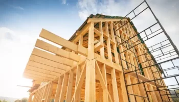
drone thermal imaging for building diagnostics gives development teams condition data on existing structures within a prospective acquisition site. This is before demolition, renovation, or adaptive reuse planning begins. Thermal sensor passes across rooftops and facades to identify moisture retention, insulation failure, and thermal bridging within existing building stock. That data feeds directly into structural assessments, renovation scope estimates, and infrastructure evaluation processes that determine whether a site’s existing conditions align with the development program planned for it.
Existing structures on development sites are assessed for retention value, demolition complexity, or adaptive reuse potential as part of acquisition analysis. Aerial thermal and visual imaging produces condition documentation across all structures within a site boundary within a single mobilization. This gives development teams a consolidated asset condition picture before committing to a purchase price or development program.
Ground conditions assessed
Aerial surveys cover site conditions beyond the building envelope that affect development feasibility directly. Drainage performance across the site, surface condition of existing hardstanding, boundary structure integrity, and vegetation distribution all appear within aerial imaging data. To assess earthwork requirements, infrastructure connections, and site preparation scope before acquisition, developers need this information. A development program needs to account for drainage issues, vegetation encroachment, and boundary complications.
Topographic data collected through LiDAR sensor passes during aerial surveys produces detailed elevation models of the site. Ground survey methods cannot match these models in terms of resolution and time unless they coordinate access with the models. Pre-acquisition survey timelines are highly compressed for large sites with varied topography.
Planning decisions supported
Aerial survey data support acquisition planning and regulatory assessment. The outputs produced during pre-acquisition surveys carry forward into planning applications, environmental assessments, and structural reports without duplicate data collection. Specific deliverables that development teams carry from pre-acquisition aerial surveys into subsequent project stages include:
- Georeferenced site orthomosaics that provide accurate base mapping for planning drawings and site layout development
- Thermal condition reports on existing structures that inform demolition or retention assessments within planning applications
- Elevation models supporting drainage design, cut and fill calculations, and civil engineering scope assessments
- Boundary and site perimeter documentation supporting land registry verification and title plan confirmation
- Facade and roof condition imagery providing structural assessment teams with pre-inspection data before detailed surveys begin
Development programs absorb the consequences of site conditions that pre-acquisition assessment did not surface. Aerial surveys conducted before contract exchange give development teams condition information at the stage where it carries the most practical value. Identifying thermal anomalies in an existing structure before acquisition prevents remediation costs post-purchase. A drainage pattern identified across the site before planning begins influences infrastructure design at a stage where redesign carries no program consequence.
Aerial survey programs sit at the pre-acquisition stage because condition data produces its highest return within a development process. Their information guides acquisition decisions, development programs, plans, and construction budgets. This is precisely the position development teams need reliable site intelligence to occupy.